Add city
This opens a side menu containing the following input fields:
- Name: the english name of the city
- Name (Ar): the arabic name of the city
- Location map: a map that helps the user map out the borders of the city through the city mapping tool

tip
To add a new city the user must press on the “new city” button in the cities page.
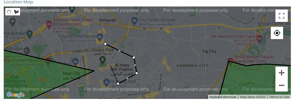
City mapping tool
The city mapping tool which has:
- A full screen button
- A find my location button
- A zoom in and out buttons
- A toggle button between start and stop drawing
- When choosing the start drawing this makes the mouse a drawing tool
- When pressing the drawing tool on the map it puts a point on it which represents a polygon point of the polygon that represents the city area
- When putting a point on the map a line appears attached to the drawing tool and when the user presses on another place in the map a line appears between the two points
- The user will continue drawing lines until they form a polygon of the city
- The user can after that move the points to manipulate the shape of the polygon and can even move the polygon itself to change its location
- The user can also find on the map other polygons representing other cities in the system
note
When the user finish drawing the polygon they can discard the polygon by the delete button that appears when they finish drawing the polygon